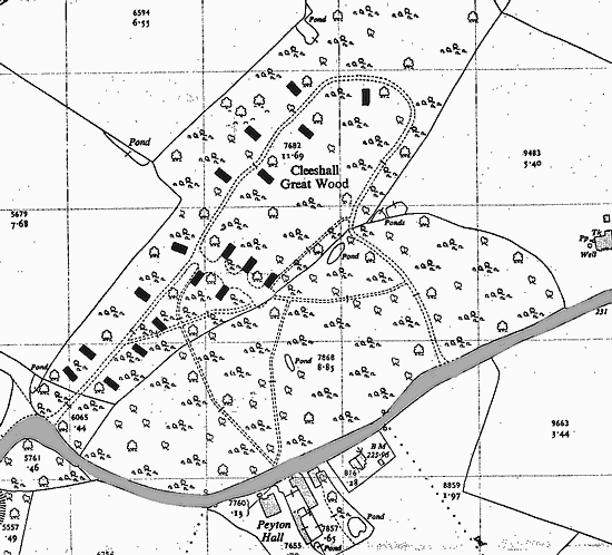
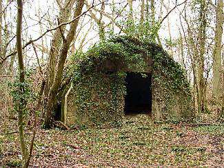
Forward Ammunition Depot 1942 - 1945
Bures Ordnance Ammunition Depot AAF526
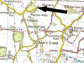
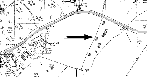


map
Peyton Hall


Peyton Hall and Great Clees Wood
map

This post war map of Clees Great Wood shows 16 huts (may have been more) with their associated road network.
Today little remains of the buildings apart from the concrete foundations. The roads originally were of concrete but this was removed after the war.
The roadway is still clearly visible as woodland farm track. The huts most probably were used as housing for the air force personnel

NOTE:- This is Private Property


map

hedge

Additional huts to the right of Peyton Hall and Clees Great Wood.
This map shows 4 enclosed huts and 10 open ended.

Nothing remains of these today, arable land.

Photograph taken 2005, clearly shows a break in the hedge which allowed access into the field.


shelter
shelter

Typical enclosed hut in Great Clees Wood
"Handcraft" Hut

These had pre-shaped asbestos sheets for the roofing and metal window frames.

Acknowledgment to:
Trevor Riches, Arthur Kemp
Ravensfield Farm, Peyton Hall.
David Anderson, Clees Hall